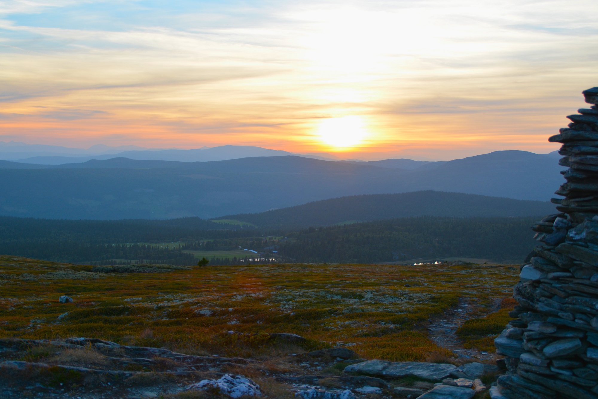
Hiking

Season: June–October
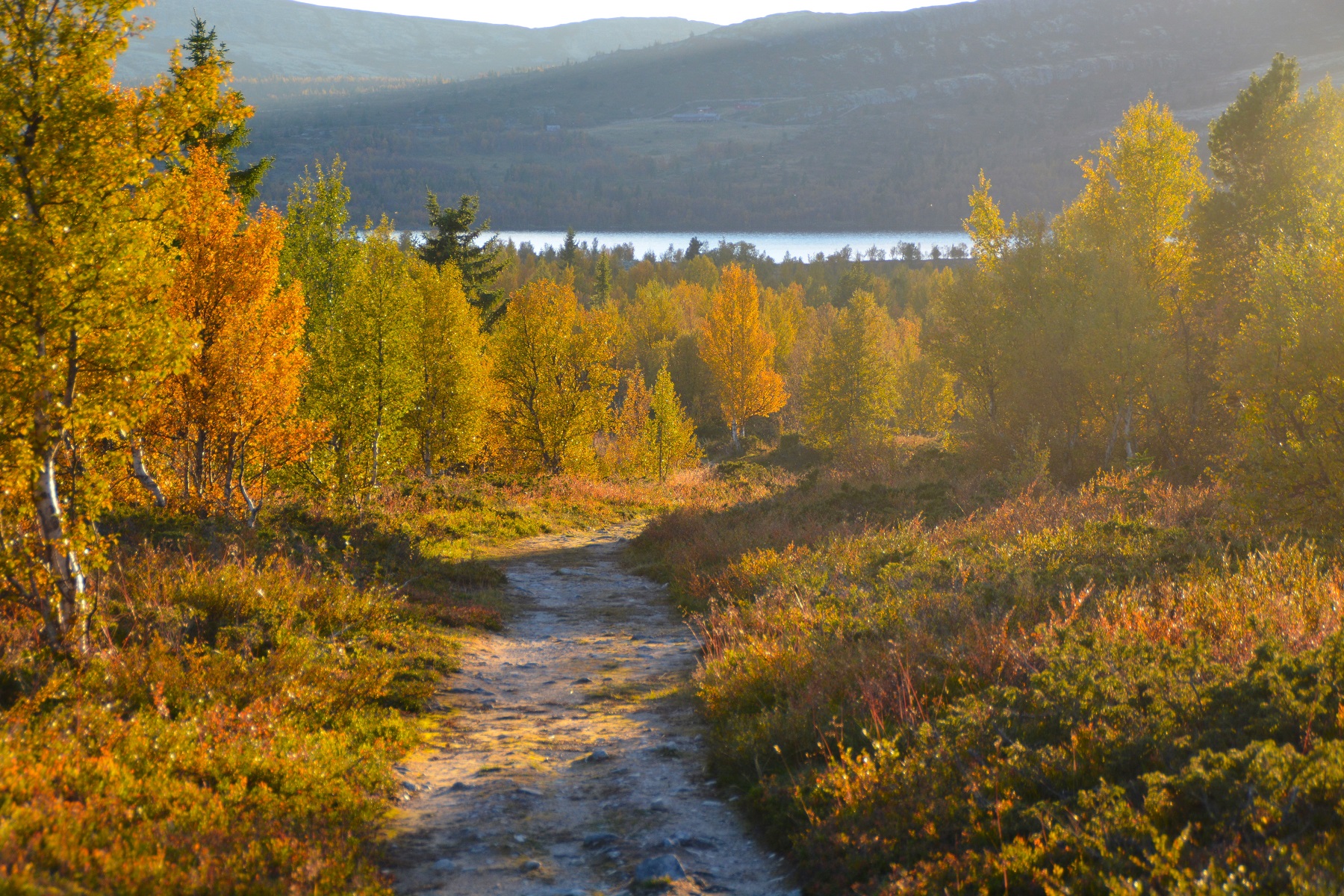
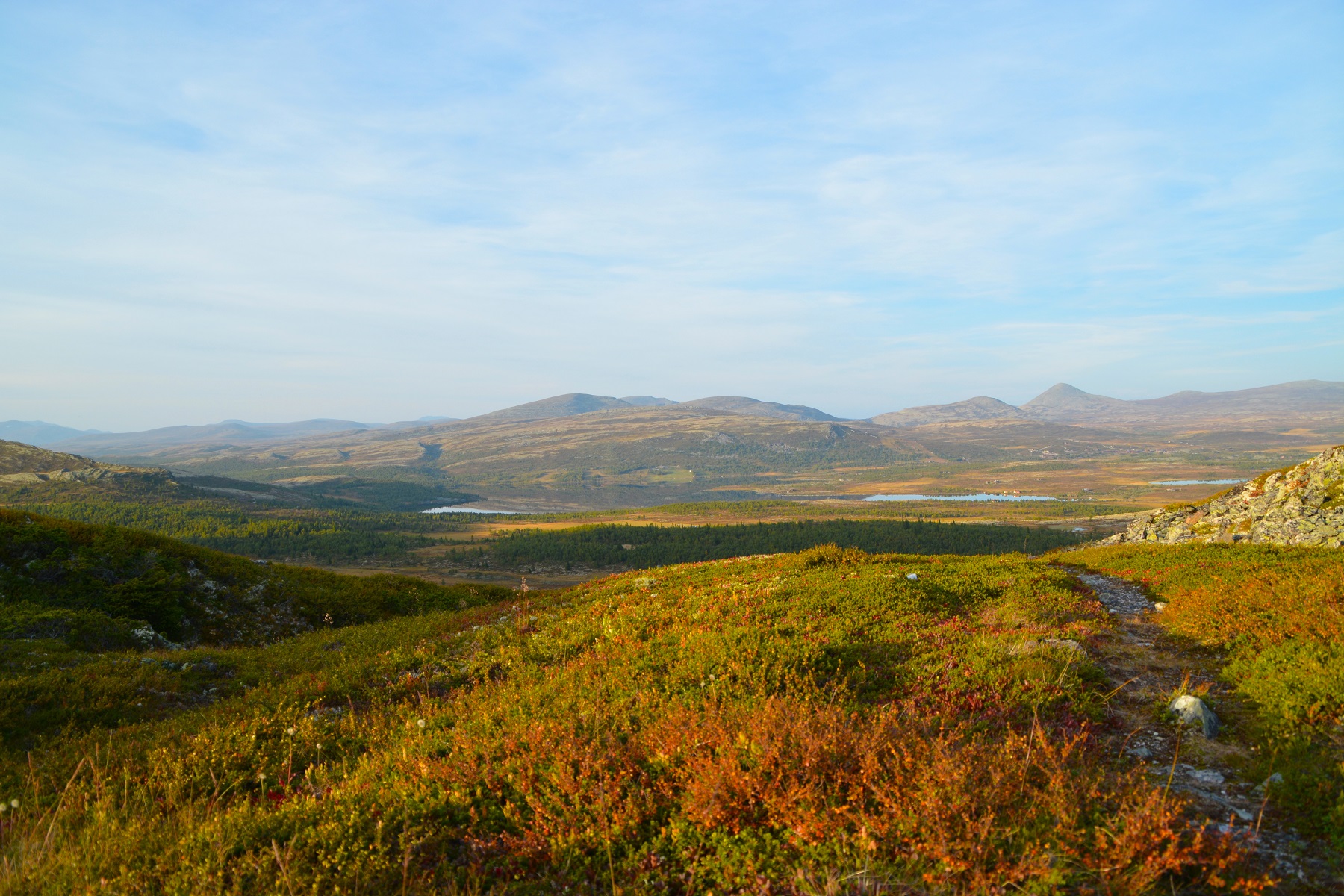
In the Summer months there is a network of marked hiking trails in varied, rolling mountain terrain. Birch forests, open terrain and over 30 mountain peaks are within hiking distance. If you wish to experience the best of the mountains, we recommend you join one of our guided walking tours!
Popular hiking trips at Venabygdsfjellet:
Myfallet waterfalls
Length:
11 km
Time:
Ca. 4 hours
A nice family-friendly trip in gentle terrain, but a bit rocky in places. Spectacular waterfall, especially early in the summer or after rainfall Start at the footpath sign opposite Venabu Fjellhotell entrance. Follow the T-marked path parallel with the road and then into the birch forest on path and then gravel track, 2km to the river Mya. Cross the bridge and follow the trail up and behind the houses. After another km you cross the stream in Bjørndalen – straight on to the viewpoint or right to the base of the waterfall. Beware that the footpath to the bottom is steep and rocky (but worth it, although it adds an hour tio the trip)
Walk back to the houses and take the T-path to the right and the plateau. At the stone built house, either follow the path to the summit of Veslefjell (1034m) or round to the left. Both paths leads back to the Mya river (bridge) near Forrestadseter where you turn left and return to Venabu/Lundes or you can walk (right) to Spidsbergseter.
Distance: 11 km (whole tour), waterfall and return, 6 km.
Time: Ca 4 hours (whole tour), Myafossen waterfall 2.5 hours
Parking: Venabu fjellhotell / Lundes / Spidsbergseter
Recommended stop: View over waterfall and summit of Veslefjell.
Turen går i lett og tørt terreng, noe steinete stier.
Veslefjell (1034m)
Length:
8 km
Time:
Ca. 2 hours
Start at Forrestadseter, cross bridge over river Mya. Follow gravel track uphill to the cabins and then obvious path to the summit at 1034m.
Continue on the other side to a single stone built cabin where you turn right on a good footpath through the birch forest to the west of the hill. Easy terrain, some rocky parts.
Can combine this walk with Myfallet waterfall or Dorfallet.
Dørfallet waterfall and canyons
Length:
15 km
Time:
5 hours
Cross main road at Saltashaugen parking and follow path. Cross old bridge over Mya, and continue past Brennflya , joining the T-marked path past Gråhøgda and keep right. The path continues to Dørfallet waterfall. On the other side of the river, on a slight rise, lie three old reindeer traps. Folow the T-path past the 100m deep canyon of Dørjuvet. The T-path continues to Veslefjellet and the stone cabin. Return to the main road via the summit or the flatter route around the mountain.
The trip is in an open plateau with some wet boggy patches.
Muen (1424m)
Length:
5 km
Time:
Ca. 2 hours
Muen is the characteristic summit on Venabygdsfjellet, with a height gain of 400m. The path goes in very rocky terrain and a path has been cleared and goes in short turns up to the summit which is covered in a large number of cairns. Great views from the top in all directions. To the east you’ll see Alvdal Vestfjell (1827 m) with its two pyramid summits.
It takes on average an hour to the summit and a bit less to return. It’s just over 2kn from the road. Children over 5 can also join for a family tour, just remember to ake you time and plenty of water.
Muen–Gråhøgdbu
Length:
17 km
Time:
5 hours
Car to lake Muvatnet and take the path towards the summit of Muen. After about 1km you join the T-marked path whih goes past Gråhøgdbu & Dørfallet to Venabu. This is a popular walk in gentle terrain although can be wet in places. For the fittest, take the summit of Muen as well. The first steep section has a new footpath to the right.
Dynjefjell (1157m)
Length:
17 km
Time:
4-5 hours
Follow the gravel track to Svartfjellsetra (summer farm). Initially the same path as thought to the Svartfjell summit, but continue straight on at the junction. There’s some very wet parts in the beginning and the footpath isn’t very obvious but after that it’s clear all the way. The path up the summit is steep but not dangerous. On the way up there’s a small plateau and a small lake for a great chnace to take a breath. The view from the summit is sensational. If you don’t want to return the same way continue over the top to a crossroads and turn left. Steep at first here until it flattens out where youturn left along a wide path back towards Svartfjell.
Bånskaret and the reindeer traps
Length:
11 km
Time:
3–4 hours
Drive to the point where Lake Muvatnet empties out and take the path to Flåtjønnet. Continue south on an old footpath through the col of Bånskardet. Here you’ll find many former reindeer traps in amongst the rocks. They lie towards the bottom of the col. the path continues to Øygardsetra if you want to walk back to Spidsbergseter, Venabu or Lundes. The path is mostly easy terrain with a few wet patches by Bølvatnet. From Bånskardet you can extend the walk to one of the summits of Bølhøgdene.
Ramshøgda (1463m)
Length:
14 km
Tidsbruk:
4–5 timer
Car to Muvatnet and path to Flåtjønnet, then north on a clear path and over the stream to Ramshytta shepherds cabin. T-marked path up the steep hill with Ramstindan on the left. Once up on the plateau turn right and make your way to the summit at 1.463 m. Great views of Rondane national park and return the same way. Keep an eye out for the change in flora by the shepherds cabin as the soil is calcium rich and unusual flowers flourish here. With the exception of the steep hill from the cabin, the paths are easy and not too rocky. Alternatively, you can walk along the road to the cabin (closed to cars). This makes the trip 10km and takes about 3 hours.
Svartfjellet (1154m)
Length:
12 km
Time:
3–5 hours
Walk the Flaksjølivegen road and then the Svartfjellvegen road to the foot of the mountain. The path follows the ridge all the way to the summit at 1154 m. Follow the same path in return until you reach the gravel trail and then take the wide path to Holtesetra. If you choose to take the summit of Dynjefjellet it adds an extra hour to the walk but the rewards for the view are worth it.
The walk goes in an old summer farm landscape with good footpaths and trails. The ascent can be a bit exposed for some
Kyrkjegardsfjellet (1046m)
Length:
10 km
Time:
3–4 hours
Take the path from the sharp corner at Venabu Fjellhotell. Walk down the steep Friskedalen to the farm at Friskedalssetra and then along the road (private) over the stream. Follow the road to the left, then the wide path to the right towards the ridge of Kyrkjegardsfjellet. The footpath to the top follows this ridge. From tjhe summit you are rewarded with views south over the Gudbrandsdal valley and west towards Jotunheimen. Continue over the summit to a well marked junction and then good paths back to Venabu.
Paths are dry with few rocky parts, but in places steep.
Family trip around Lundes, Venabu & Spidsbergseter
Length:
7 km
Time:
2 hours
Welcome to Venabygdsfjellet!
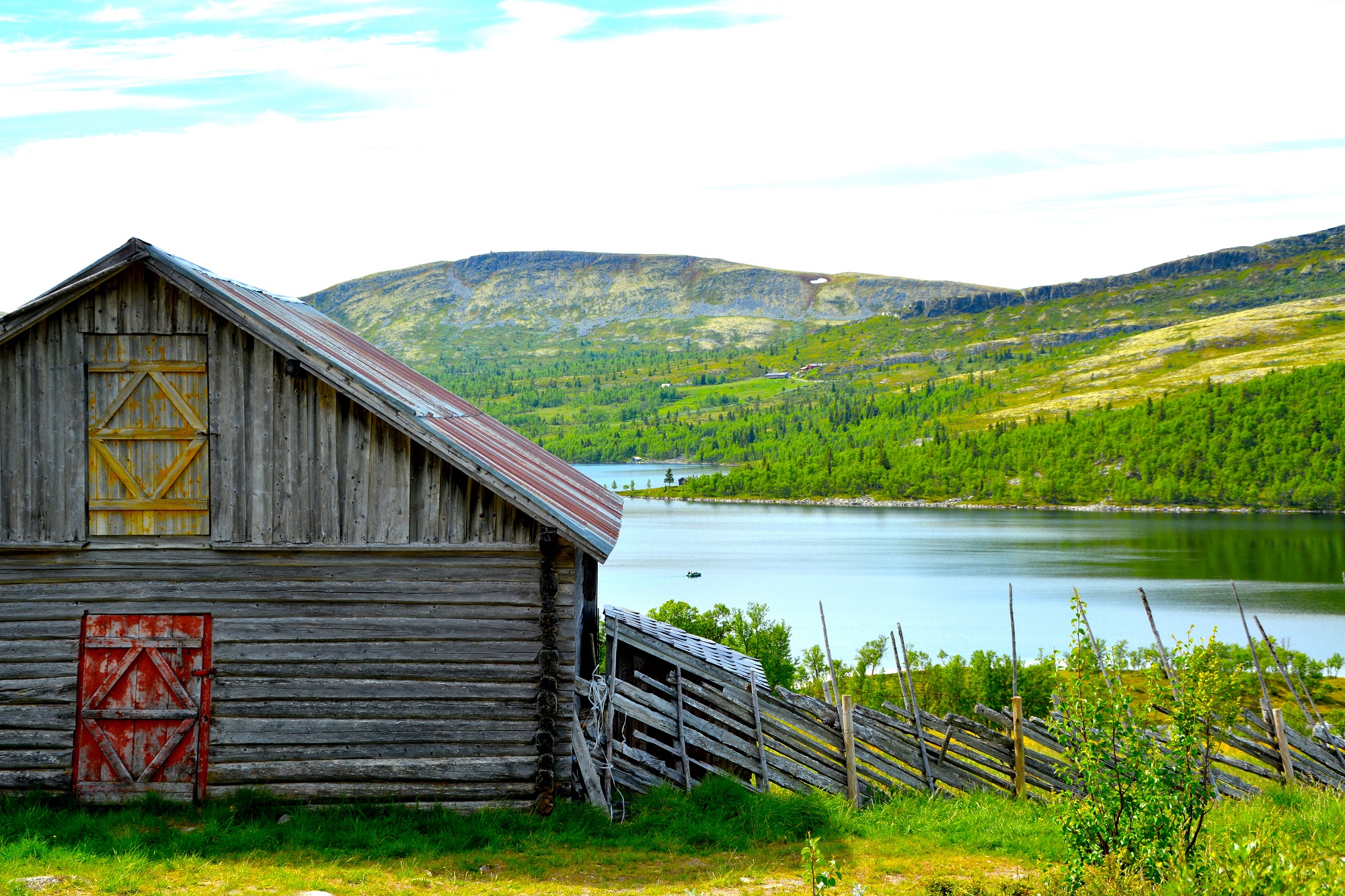
Venabygdsfjellet is a mountain area in the municipality of Ringebu. It lies between Gudbrandsdalen and Østerdalen. It has a good snow record from December to April, a stable winter climate, and fantastic ski terrain.
The Venabygdsfjellet plateau is on the southern edge of Rondane National Park, at an altitude between 850 and 1000 metres. The terrain lies partly in the birch forest belt and partly above the tree line. The mountain peaks are 1200–1400 meters and offer superb views in all directions.