Mountain Biking
Season: June–October
Venabygdsfjellet is for many a well kept secret for mountain biking. In 2016, the Norwegian magazine “Terrengsykkel” joined a guided tour which resulted in a front page picture and a 14 page article. Enjoy a relaxed family trip or an adrenaline filled mountain bike adventure on Venabygdsfjellet!
Popular biking trails at Venabygdsfjellet:
Around Svartfjell
Level:
Advanced (Gravel track in and out, technical path around the Svartfjell mountain)
Length:
14 km
Time:
1.5 hours
Start at Spidsbergseter, Lundes or Venabu. Follow Flaksjølivegen until crossroads«Svartfjellvegen». Follow Svartfjellvegen for 2 km to the base of Svartfjell. Follow the path straight on upwards for ca. 100 m, then take a small path to the right past the summer farm (may have to walk here due to large rocks). Once you’ve passed the fence you’re on your bike again and it’s an easy to follow path, but a bit damp in places. Please respect the natural environment and avoid making new paths. As the views of Rondane open up, there’s a great descent for a while before a few up and down hills. Stop here and look backwards and you’ll see the path you’ll be going up later. As you rejoin the birch forest and cross a little stream you take a small path to the left (keep an eye out). It’s a long uphill and you may be walking as you near the top but the views are worth it! And the downhill section is the best bit of the tour. Please remember that this area can be popular with walkers and they have priority on the trail.
The descent is technical in places with some drops and narrow twisted sections but for the most part comfortable cycling. Expect to carry your bike at times though. Eventually you’ll join Svartfjellvegen again and return the same way as you started.
Family tour to the foot of Svartfjell
Level:
Easy (gravel)
Length:
10 km
Time:
1–1.5 hours
Start on Flaksjølivegen gravel trail from Spidsbergseter, Lundes or Venabu. Cycle towards Flaksjøen lake to the crossroads «Svartfjellvegen». join this roda and follow for 2 km (good views towards Rondane from the bridge). From here it’s a bit of a climb but on a goodgravel; track to the foot of the mountain. If you want to take a break from the bike it’s possible to walk to the top of the mountain, about 45 minutes each way. Otherwise enjoy the views and return the same way you came.
If you’ve still got some energy and fancy a good picnic spot, turn left when you rejoin Flaksjølivegen until you come to a large crossroads. Straight on here for about 500m before taking another gravel track down to the left. Here you’ll find a nice spot by the boat shed with a small dock.
Round trip past Spidsbergseter, Lundes & Venabu
Level:
Easy / medium (both gravel and path)
Length:
7.5 km
Time:
45 min–1 hour
From Spidsbergseter on gravel road towards the main road. Join the trail by the first house on the right to the Spidsbergseter signpost. Take the path to the right following parallel to the main road until just after the Forrestadseter summer farm. Cross the road here and stay roght using the higher trail. When you come to the gravel road turn left and then shortly afterwards right on a summer farm road. Follow this for a short while before taking an obvious path to the right. It’s a bit rocky in places so be prepared to walk for a bit.
The path meets a new gravel path at the bottom of a hill which you follow for a couple of kms until you come to a large crossroads. Take the path to the right which leads to Venabu (some railway sleepers over the marsh near the end). Cross the road and past the dock to the left following the lakeside path. Once you meet the gravel track, turn right and follow until it turns into a path. Keep straight on to return to Spidsbergseter. At the end of the path you have a choice to go to the hotel over the bridge or take the right on the gravel track and on to Flaksjølivegen.
You can also cycle from Lundes , following the path which goes parallel to the road up to Venabu and then turn left at the lakeside dock.
Brennflya – Dørfallet – Veslefjell
Level:
Medium (mostly path, but not too hilly)
Length:
14 km
Time:
1.5–2 hours
Start by parking at Saltashaugen (blue tractor), don’t forget to pay! From here cross the road and onto a clear path until you come to a large bridge over the river Mya. From here take the path to the left for a few kms, It’s very wet in places but worth it once you get past.
After a good part of the trail, turn right around Brennflya, a fantastic single track with good fun corners. At the next junction continue straight on over a few wet patches. As you come to a larger path you turn left and either cross the stream to see Dørfallet waterfall (same way back), or you join the T-marked path to the right. It’s a good path with some great views of the Dørjuvet canyon. At the next big crossroads, turn right towards Veslefjell.
You can finish the trip by going to the summit of Veslefjell – and a great gravel track back down again! or continue underneath the mountain along a mostly wide and dry path.
The last part to the gravel road is rocky. Once on the gravel road, go downhill but don’t forget to brake as there is a barrier on the bridge.. Keep going up the other side and take the footpath towards the summer farm before crossing the road and the footpath parallel to the road back to Saltashaugen.
Kyrkjegardsfjell
Level:
Medium (A technical difficult descent)
Length:
11 km
Time:
Ca 1.5 hours
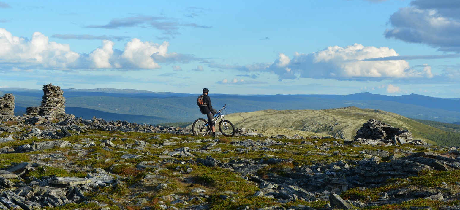
Start at Lundes Turisthandel, following road towards Ringebu. When you pass Rondevegen Turistsenter, cross the road and use the path which goes parallel. After 1km at the top of the hill, follow sign for Kyrkjegardsfjellet to the left on a gravel track. After 500 metres at a crossroads, keep left around the corner. After a sharp left, take the next gravel track to the right, again signposted Kyrkjegardsfjellet. The path is between two cabins. It’s a good solid path and you can cycle all the way to the summit with spectacular views of Venabygdsfjellet, towards Kvitfjell, Jotunheimen and also back to Rondane.
After catching your breath, continue over the summit ad past the cairns. The first part of the descent is great fun and quite easy, but watch out for some drops. The latter part goes through the forest and is somewhat steeper and rockier. Beware that the rocks can be very slippy when wet.
At the bottom of the hilI, you’ll meet a cross country track where you turn left. When you see a sign at the crossroads, follow Trabelia. This next part is on good wide paths, used as ski trails in the winter. A bit up an down but no big challenges. Pass the lake Gulltjønnet on your right and after a further 1km the path meets a gravel track. Follow this uphill until you are at the top by the road again. Do another circuit or return to Lundes where you started.
Welcome to Venabygdsfjellet!
Venabygdsfjellet is a mountain area in the municipality of Ringebu. It lies between Gudbrandsdalen and Østerdalen. It has a good snow record from December to April, a stable winter climate, and fantastic ski terrain.
The Venabygdsfjellet plateau is on the southern edge of Rondane National Park, at an altitude between 850 and 1000 metres. The terrain lies partly in the birch forest belt and partly above the tree line. The mountain peaks are 1200–1400 meters and offer superb views in all directions.